Wednesday, 18 March 2015

My Arctic Love

As a rather lazy man these days, I've been strongly neglecting my blog page, partly due to my inability to write worth a dam, but I've also been waiting to actually find something to write about.

After spending the last 5 weeks among snowy valleys, tidewater glaciers and a lot of like-minded folks, I still feel that I have very little to write.  And this stems only in part to my crappy writing style, but more so that it is difficult to put into words what Svalbard means to me.

The Norwegian Arctic Archipelago lies ~1500km north of TromsΓΈ in the Barents Sea and for the last 5 weeks and on previous occasions has been my home.  And I use 'home' not just as my location for more than a few days, but as somewhere which keeps bringing me back and somewhere that I feel genuinely attached to.  I often contemplate what it is that appeals so heavily to me.  I contemplate this on the 30 minute walk from the main town of Longyearbyen up to the old mining barracks where many of the students live... a journey which sees some pipes sticking out of the ground, a reasonable amount of traffic (some teenagers revving their snowscooters) and an occasional foul odour which lingers around the Gym Hall (I don't think it's people in Gym).  I further contemplate this when half of my daily energy, which is sapped due to the general lack of sun associated with time of year and cloud cover, is consumed by planning a simple trip up to a local peak due to acquiring a group size reasonable enough equipped with rifles, crampons, avalanche gear etc etc.

Yet when it all comes together when you reach a peak, the sun lifts itself above the valley and throws some much needed vitamin D your way!  When you take a scooter ride with many great friends to a glacier that you visited during summer.  It now looks completely different, and yet so familiar that you forget that you are currently standing on sea ice where previously you needed a boat to get the same view.  Or perhaps its the ability to abseil into the base of a glacier through a network of stunning tunnels which were successively carved deeper year by year from highly velocity melt water during the summer.

As I often like, I want to share some photos of said experiences as no one wants to read about cool things when you can see them.. Unfortunately the total number of pictures taken by me is == 0.  Thus I hope to rely upon a few borrowed (and credited) pictures of others whom I was generally with at the time and hope they don't mind too much.
First weekend - -22C, 25m/s wind, let's do the macarana (Photo -Mariana Esteves)

Igloo above an ice cave on Longyearbreen, I would totally live here (Photo - Saskia Gindraux)


Longyearbreen ice cave- interesting features eating my arm (photo -Jessica Scheick)

Scooter trip to ScottTurnerbreen during the first week (Photo - Noel Fitzpatrick)

Chilling above Gruve 2, some nice stars (Photo - Andi Alex)

My first northern lights, so awesome (Photo - Andi Alex)

Return of the Tunabreen... so good to be back, I was even considered a responsible person and thus awarded a bright orange jacket! :) (Photo - Michele Petrini)


Sad to now be sat in an empty room with bags yet again packed to leave behind my homely arctic island... until next time.

But to all those who have shared good times, good trips and good elevator parties with me over my time here, I say thank you, take care and ha det bra.


Wednesday, 31 December 2014

My new career 'posing' as a modeller

Holy crap... I've been in Newcastle almost a year now already!!... and a helluva good time it's been all in all.  But a year which has felt faster than Pine Island Glacier ( I know... what a sucky glaciologist reference to a fast flowing glacier), but as I am already officially into my second year of my PhD it gets you thinking about what has already been achieved and what milestones there are ahead... and what better time to reflect than a lazy afternoon on New Years Eve?

Back at my postgraduate induction to the conveyor belt that is the university system, a talk was given by a third year PhD student in engineering who spoke of the various moments where a big ?? comes into your thoughts of your PhD project.. why am I doing this?  Is it important?  Is there any point?  And surely enough, these questions are commonplace in my mind as I stare at a spreadsheet full of numbers or a Matlab script that is underlined in copious amounts of red squiggles that I don't fully comprehend just yet.
A great example of what a PhD is summed up by a few simple diagrams in blog post by Matt Might that I saw earlier this year here:  http://matt.might.net/articles/phd-school-in-pictures 

The blip that is PhD research.. Sourced from above link


A small blip in the mad world that is research.... but something which contributes at least a little way.. and for me that little piece of a contribution is enough to make me work at these next two years of my life and whatever is beyond it.

A large hurdle of my PhD so far has been learning to make my computer do the work and let me put my feet up (i,e. running numerical model simulations).  Albeit with a lot of help and the framework of a working model already existing, I have managed to make my PC tell me a series of numbers and make pretty(ish) graphs from numbers I put in and conditions I set... then I go and watch the Hobbit or some crap film in the cinema, leaving a note for no-one to turn off the PC in my absence (mostly me doing it accidentally) and return to find the computer to have given me a series of results... some good, others..less so.

Model Running... Don't Touch!  :)
Modelled (blue) vs measured (red) melt at individual stations... some irregularities at some stations due to averages from short periods of measurement, prone to error.  


So here I am after nearly a year, with a great data set and a generally successful field season on the Miage Glacier in Italy (even considering the misfortune of Septembers field trip), some results to show, some lessons learnt, decent portions of time staring a screen with a blank expression and an almost complete energy balance melt model to run with different simulations of temperature distribution....   For where I am at the first year hurdle things are looking pretty darn good....

Every IS coming up Milhouse!


 ...still plenty of things to go wrong between now and a viva... but that's 2015's problem!


Just thought I'd share a few highlights from my year (despite Facebook's pressure to publish its auto-moments of 2014... and me agreeing to get it off my timeline)..

Happy New Year all

April fieldwork, lovely conditions and me making a first attempt at skiing :)


Being part of Mark's Grand Alpine Tour and doing some surveying of landslides...  some a tad risky in hindsight 
'Lovely' weather hikes in Svalbard 


And some funny ping-pong and cycling moments of course :)


Sunday, 5 October 2014

Lessons from 'cursed' fieldwork


A pretty fantastic summer has come to end... though i'm a little late with reluctantly welcoming the autumn.  The summer months have been a wonderful mixture of Alpine adventure as part of the RGS Land Rover Grant and some PhD research at the foot of the impressive Mt Blanc Massif (and the associated sights that come with it).  After having just finished my fieldwork for the first year on the Miage debris-covered Glacier, it makes you reflective on what problems can occur during glaciological fieldwork, how important it can be and how annoyed it can make you.

Fieldwork last week consisted of 4 days of back-breaking transportation of tripods, weather stations and dataloggers over 10.5km squared of loose and slippery debris.  The following are the primary things that went wrong for us:

1. Stolen timelapse camera

To monitor the retreat of the snowline on the upper part of the glacier for running a distributed energy balance model, an expensive Harbortronics camera was mounted on the opposing valley and 'secured' to a large un-movable boulder (for me) sticking out from the ground.  As the camera was placed somewhere off-track and out of sight, the return to the site with a GPS in hand was almost necessary to get to the spot exactly after a 300-400m climb from the main route past the glacier.  To my surprise the boulder to which it was attached was smashed and the no trace of the camera was left.


- Important?
The data would have been useful and informative, though not crucial to my project... just an expensive camera

-Level of anger?
HULK SMASH (sad that nothing is safe, not even for research)


2. Flat tyre

A nice rental of a Skoda Superb (it was good... superb?? not sure) from Geneva airport gave us the space we needed to wedge all of our equipment in and return it to our storage location in Courmayeur.  Following a fantastic pizza from our usual favourite in the town, our journey back to the valley was met with an unfortunate hole in the road and a completely flat tyre.  Due to the inability to remove new car tyres without better tools and likely a health and safety concern, we were surprised to find a spare tyre hole with a lack of a tyre and just some puncture 'goo' not to dissimilar to what you put in your bike tyre to prevent punctures.... unsurprisingly it didn't work, though was designed as a 10 minute assistance anyway.

-Important?
The hassle to fix this was more of a cost to time (we lost our ride up the valley) and left us a man down for a while.

-Level of anger?
**it happens.  It was already 10pm when it happened, we just wanted to go to sleep... :)


3. Pro-glacial station somewhere in the Med.

Following 82mm+ rainfall during ~24th August (I wasn't there at this time) a major flood and the drainage of the ice-contact Lake Miage occurred (see below).  The destruction to the area beyond the main portal (exit) of water from the sub-glacial system was incredible, with new water routes carved into part of the glacier and much of the original river walls.  Unfortunately we were operating a pro-glacial station to measure changes in water depth and electro-conductivity of the material held in the melt water.  Again following our GPS led to an unhappy result.... our GPS informed us a further 5m forward would bring us to our location.... down a steep bank into the now-centre of the river.  Now these GPS units have a variable accuracy and would sometimes position us somewhere between the original pro-glacial station and Texas.. but it was clear to see that it wasn't here anymore.

The former image of the Miage Lake and two pictures of the drained lake and the crater remaining

Just a small part of the damage caused by the flood and the GPS with location of the station 5m ahead.


-Important?
The data again was supportive, though not crucial.

-Level of anger?
To be honest... the destructive power of nature was just impressive... it sucks to lose useful data and a good datalogger.... but its hard to argue with this one.


4. Waterproof temperature logger?

One important piece of data since mid-August that is potentially lost derives from a waterlogged temperature logger which was tightly sealed and considered waterproof.  One of the veteran stations from the April set-up had given up on me and became the only casualty of the main dataset this season.

-Important?
Yes!  Though the data for the rest of the stations is present and still comprises a unprecedented dataset of this nature over a debris-covered glacier to my knowledge.

-Level of anger?
I'm not angry... i'm just disappointed.


5. R.I.P. Camelbak

Following shifting a lot of heavy equipment in my backpack down the glacier, a quick lean against a rock to take the weight of my pack off me with taking it off and putting it back on in struggle resulted in a popped water pack :(

-Important?
Water is always important...

-Level of anger?
As fed up as anyone with a wet arse and no more drinking water


Ultimately, this felt like a slightly cursed trip to the Alps... but things could have been much worse.  Looking at the wider-picture, it becomes clear that bad things often happen with this type of fieldwork and projects may have to adjust to what is available.... I'm just glad that my hasn't changed too much.

Now on to the data-processing!

Sunday, 6 July 2014

Invasion of the Celts

Holy Celtica!

  The valley below the tongue of Miage Glacier, home to me for the past two weeks is well populated by axe wielding, beard sporting, kilt wearing Celts!  It's a mixture of bizarre and amazing, with some great music and crazy dress codes.  My time on and off glacier has been supported by some bagpipes, violins and drums since Thursday... the fact that my tent has been boxed in by mobile homes and barking dogs is only mildly irritating considering I gain a free festival of music and character from the comfort of my wifi enabled hammock... sweet!  More on this here.


Some cool tree decorations... didn't get a shots of axe wielding Celts though.  


Resting my feet after a solid 2 weeks of glacier trekking feels good, though with plenty of data to organise already.  The main reason the feet have become destroyed from glacier trekking may have something to do with the relentless presence of debris on the surface and rapid change and retreat of it's ice cliffs, where ice exposed to the air at such a low altitude rapidly melts and shifts the pattern of rock and sediment.  The main annoyance is the movement between the upper an lower glacier.  My common description is like the beginning of the second Lord of the Rings installment where Frodo and Sam are attempting to get to Mordor but get lost scrambling around the similar appearance of jagged rocks.  Thankfully access to the upper glacier alone has a wonderful route around the western moraine ridge with a view over the Lago Combal + a lovely 200m climb to the glacier.


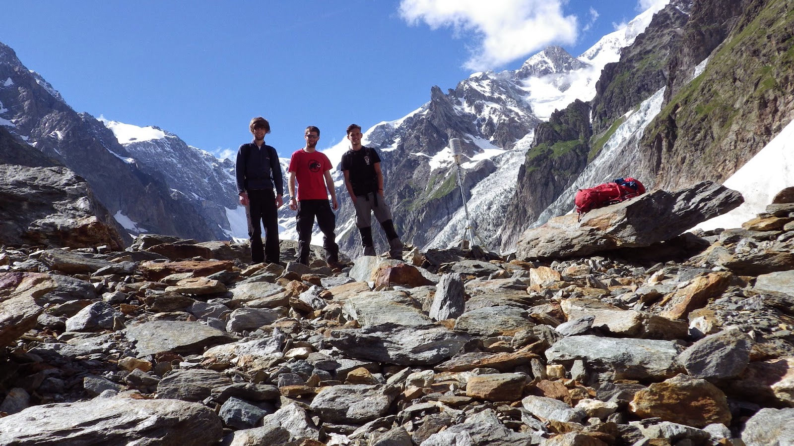
Happy to say now that since the beginning of July all my temperature stations and weather stations are in operation even though the 'amazing' GPS locates them somewhere between here and Argentina.  Following this, each station has been neighboured by a 2m PVC pipe from B&Q to act as a measure of melt under the different surface types and elevations up the glacier.  Manually drilling into the ice after digging up nearly 1m of debris at times really makes you appreciate the ability to attach an electric drill to the end of it (as was the case in Svalbard).  The fact that some anonymous undergraduates clearly blunted it through drilling in to debris didn't help progress... but replacing the blades of the drill then made me practically fly into the ice!  thank you Kovacs and your sharp drill heads, you saved me from a midnight ice drilling attempt...


Now I plan to enjoy a more relaxed stroll across the Miage over the next week to monitor my ablation stakes and download station data before I leave.  Accompanying me will be some scary Celts and some weather with mixed feelings.  Funnily enough, I get the strange looks for being geared up with ropes and ice axes, this bald, kilted guy needs to take a look at the blue paint on his face an return to his Celtic horn.

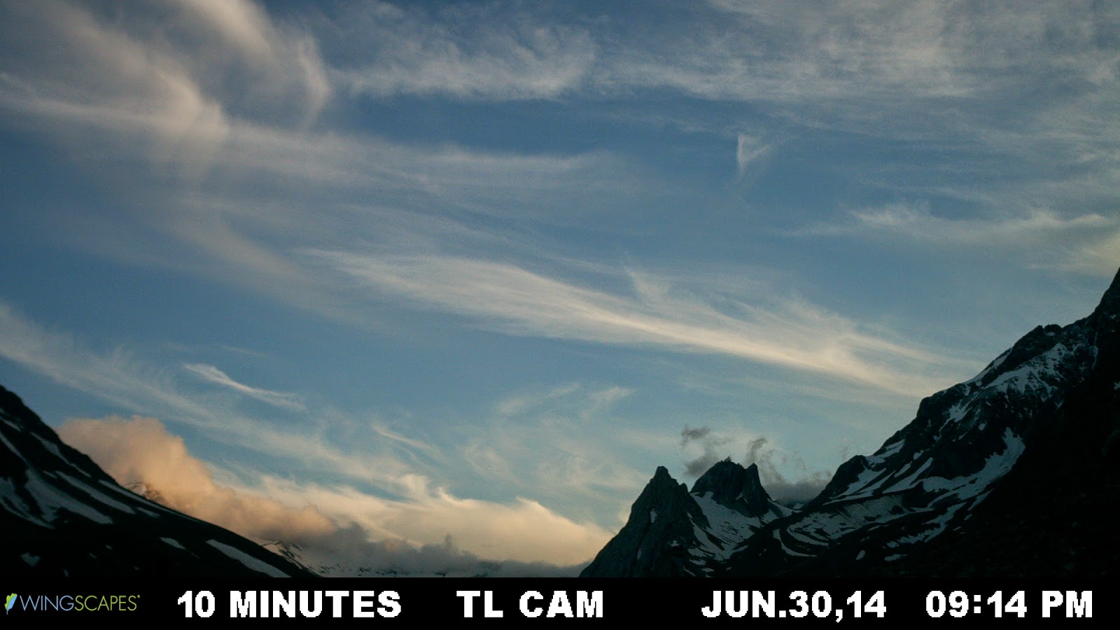
I leave you with a few time lapse images of clouds (used for science purposes... honest) over the lower weather station.


The camera was moved a bit for the last two.... not enough clouds :)

Thursday, 19 June 2014

Glacier = 2 Swiss Francs

After just over a week out in the Land Rover, I can say I've seen some pretty amazing routes, and some things that I have wanted to see for some time (particularly in Austria).  The week's travel has taken me east along the Northern part of Italy, Aosta-Trieste, into Slovenia (amazing place! everyone must visit), into Austria, through Southern Germany, sneaking through Lichtenstein (for all of 20 minutes it takes to drive through) and into Switzerland, where I am currently held up in the Hotel Glacier du Rhone, at the foot of, you guessed it, the Rhone Glacier (RhoneGletscher).  The hotel itself is an impressive old building full of atmosphere, with a fabulous large book at the entrance showing off all the wonderful history of both the building and it's position with respect to the massively retreated glacier.

South-eastern Switzerland, the valley up to the small village of Juf

Ljubjlana, wonderful city

Bled-Slovenia, amazing colour of the water

                         The Pasterze Glacier, Austria... read a lot about this guy, good to see it at last

From some of the old images, photographs from the mid-late 1800's, you can see where the glacier tongue used to be, near the hotel, now not to be seen until you climb in the winding roads for a decent 10-15 minutes (faster in a Porsche).  I'm sure the original founder of such a grand (and creaky) building would be somewhat disappointed to find that the name for the hotel became less apparent after every morning view from his window saw a body of ice shying away.  If it was the service, the current glacier front would be making it's way back for sure... if it's the prices, then the current front of the ice should stay well up into the valley where it currently resides.  

A journey onto the glacier yesterday give me a wonderful feeling as glaciers usually do.  It reminds me how happy I am to be working in such a dynamic and interesting environment, that it shows so many small surface features that I even forget the names of... makes me a happy glaciologist.

                                       forgot the name of this fella

  My first experience of the Rhone yesterday has been both a pleasure and an annoyance.  For the first part, the glacier is wonderful example of the changes we can see in our environment, it's easy to access and it makes a nice walk, although with reasonable effort.  The annoyance derives from the fact that the only easy access and main access to the glacier is to pay 2 Swiss francs per person and walk through a tacky souvenir shop (and return before it closes?).  Essentially building a shop in front of the access point and charging you for it, unlike other locations where viewing towers etc are erected to give better views for those, who unlike me, don't want the harder climb.  This 2 Francs did include however the access the a sheltered ice cave near the current terminus (haven't been in yet).   This shelter is a tatty sheet of what was once a whitey tone, and now reflects the reduced albedo of the tongue, at least its not a circus tent of red and yellow stripes.  Im all for preserving the provision of freshwater from these glaciers, but it just feels like nature has been whored out for a couple of Francs... nothing new there I guess.

Rant aside, I'm looking forward to the next few days on the Rhone, conducting some surveys of the rock walls and trim lines using the UAV and the Structure from Motion techniques.  Hopefully to test some methods of vertical temperature profiles here too that can be compared to the debris surface of the Miage...fun fun fun :D

                                   ooooh, ablation stake :)


Monday, 2 June 2014

should-be-manned aerial vehicle

The Grand Alpine Tour is now under way, with big Landy (still nameless as far as I know) leaving Newcastle in the early hours of today.  The main method of data capture for this epic adventure is the use of a UAV which is aiming to capture thousands of images and create 3D models of mountain and valley sides to assess the frequency and magnitude of landslides that occur above melting/retreating glaciers (see last week's post).

While the primary use of the big beast of a UAV is for another PhD project at Northumbria, it is hoped (and at least partly planned) that it will be made available for my own work on the Miage Glacier as well.  By strapping a TinyTag temperature logger and probes to the awesome 'little' flying machine it is hoped that I can log some data on vertical temperature profiles above the debris covered ice.  This is particularly interesting because the boundary layer meteorology above glaciers during the summer when they melt gives an idea of the 'free air' outside of the influence of the near surface.  By obtaining averaged temperature records for 1m intervals as high as we can manage (20m?) above the glacier, should give some interesting insights into the wider scale temperature controls on melt in such regions.

To say the methodology for this is nailed would be a lie.  Due to only having the larger S800 UAV (shown again below) for a short amount of time before going into the field with it, it is more of a try it and see approach.  (a youtube clip of this particular UAV with some music/camera action, in case you were interested?)


Looking back to March time, myself and Mark attempted this idea with the small DJI Phantom UAV.  One designed more for smaller projects, with less stability against the wind and one purchased largely for the purposes of practicing the idea of flying and capturing data.  Strapping the TinyTag logger onto the Phantom and the probes to each of it's little legs, we drove to Chester-le-Street (wanted to get out of the office anyway), paid for parking, and set the UAV onto the grass of a large park that I can't remember the name of.  Realising that we hadn't brought anything to detach the cabled-tied logger in case of problems, we thought we should just go for it.


This may have been one of the shortest science experiments in the world that doesn't involve rapid particle acceleration or the like.  Instantly after lifting off, the very lightweight logger unbalanced the UAV which did a 180 degree somersault landing upside down on its propellers and chipping one of them.  END.  Shame... it looked pretty bitchin'.

With a 10kg lifting weight, the larger UAV shouldn't have such a problem... but we will see how successful that will be :)

Science... gotta love it

Saturday, 24 May 2014

Good News Everyone


Good news indeed... albeit a little delayed from the actual announcement... but this summer will be an awesome adventure of the Grand Alpine Tour, a research project and the recipient of this year's RGS (Royal Geographical Society) Land Rover grant.

 Principally organised by, and awarded to my PhD co-worker Mark Allan, the grant provides a team of people, including myself, the ability to conduct a significant fieldwork component of Mark's research project which is concerned with the frequency and magnitude of landslides which occur above melting/retreating glaciers in the European Alps.  The great interest in this project for me especially is the way in which the occurrence of these landslides impact the interaction of glaciers with the overlying atmosphere.  Because debris cover on glaciers acts to alter the response to climate, and much of the debris is often sourced from these landslide events, there is great importance attached to our need understand them.  Among several others, there will be some nice visits to the Rhonegletscher, Mer de Glace and my study glacier, the Miage.

Among other possible techniques, the main method for capturing this change is using the increasingly popular choice of a UAV (Unmanned Aerial Vehicle) or hexacopter if you will.  Constructing 3D models from mass amounts of images using structure from motion (SfM) imagery then allows this change to be realised.


  In addition to some generous funding, the grant provides the Grand Alpine Tour team with a shiny new kitted out Land Rover Defender to carry all the equipment and help us over the harder routes through the Alps.

The land rover.. looking pretty good in the pic below will be invaluable then to this project, which is represented in more detail on the webpage http://grandalpinetour.com/ ......and the Land Rover press release can be seen here


Throughout the duration of the trip, updates will be made to both twitter and facebook pages.   Give them a like/follow... interesting things to come! :)