Monday, 21 April 2014

Reflections on fieldwork and testing

It's amazing how, if you live in the city, no one casually says hello in the street or smiles without knowing you.

However, if you venture out into the countryside, you get casual greetings here, there and everywhere... particularly in England... but not only England.

This weekend, I got bored of Newcastle for the day and took the train out to Hadrian's Wall, a 73 mile long, 2/3 metre wide Roman construction designed for Emperor Hadrian's back garden because he didn't like his neighbours.


During my spontaneous trip I experienced variations in the amount of people passing the other direction, larger amounts of day trippers nearer the car parks and points of interest (the weather was good enough to give me sunburn).  I was interested to see that if there were more 5/6 people in quick succession passing by, the politeness disappears, and city life resumes.  This kind of makes sense when we consider how strange we would be to greet each passer by in such a way that quickly ('hi, heya, howdy-doo, great day eh? hey, good day, jolly good!).  I'm curious at what stage we resort to this pleasantry and when we decide there are too many people to be pleasing everyone?

The reason this springs to mind is that during the summer near (and on) the glacier, there will likely be a ****-ton of tourists.  Does this rule apply to the Italians and internationals in the valley? (most likely), do I need to explain to everyone the reason i'm walking around with radiation shields (radiation? RADIATION!?).  I'm aware it is a likelihood and it may very well be annoying.  Hopefully I can at least use some of the public services to good use that didn't exist in the April venture... such as a coach along the road which runs by the tongue of the glacier (snowmobile was more fun) and campsites in the valley... maybe I can even con some tourists with large backpacks to carry stuff for me?

The week in Italy was truly great and I managed, with the help of several people to get a total of 6 stations measuring air temperature installed at various locations on the glacier. More equipment was stashed at an upper station for ease of transportation in June, but while utilising its ability to log local temperature information until that time.  So at the upper most station where the tributaries of the other glaciers meet the Miage (see below), I established a measure of the near surface vertical temperature profile at 1, 1.5 and 2 metres over a quickly diminishing snow cover.  This will hopefully give a lovely transition between an unstable boundary layer (where surface temperature is lower than the overlying air) and a stable layer (which follows the more traditional decrease of temperature with increasing elevation).  However in June, this multiple height set up will be partly disassembled leaving the 2m measure and transporting the remaining sensors further up glacier.
This highest station was approximately 2400 metres above sea level (masl).  The highest station is set to be 2700masl.  higher than this, and the gradient increases too greatly and the inclines are characterised by risky ice falls which couldn't support stations anyway.  Higher up upon the glacier, the ice from the falls of the Mont Blanc and Dome glaciers crack and the rocks fall almost continuously (mostly in small pieces).  It reminds you how active and dangerous this region can be.  Most stations are situated in suitable and reasonably safe places, though one or two occupy areas which in 2012 was subject to a significant blowout of ice from the tributaries (picture from Fondazione Montagna Sicura).


So the stations will range from numbers 1-14 with two full weather stations and one off-glacier station (OG) designed to test the temperature changes independent of the potential cooling affect of glacier ice (even if buried under debris).


Currently it looks something like this, if I were to take a lovely aerial image from 2012 and put some inaccurate dots in paint (I'm too lazy for ArcMap today):


Though the GPSs have done a bit of a lousy job at positioning us where we should be (think my paint image is better).  This can be reasonably confirmed by ArcMap software (GIS) which shows that the coordinates given puts an off glacier station ON the glacier.  The limitation of satellite coverage in the afternoon in the upper parts of the glacier gives slightly more inaccurate readings anyway.

"anybody out there?"

I feel that after all the testing of sensors in the TomCave, the measures of temperature were reasonably accurate... but another test was conducted using all the sensors that were left in Italy from last year as well... and the results... not bad.. though a bit more messy.


The test ~700 metres from the tongue of the glacier was a good idea to test the other sensors, but also under conditions more accurate to that on the glacier, such as multiple reflections from high albedo surfaces such as snow and at similar elevations.  While one temperature sensor was giving a few too many large errors (several lines in the upper graph show comparison with it), the others were recording mostly reasonable differences in temperature and times where errors are higher can be understood better and can benefit analysis when looking at the final dataset.  The sensor with the largest error was also set up at TT10 (upper glacier) to give it a further test.

camping is booked for June.... can't wait... shame that for now, I have to stay in England with it's walls :)

Sunday, 13 April 2014

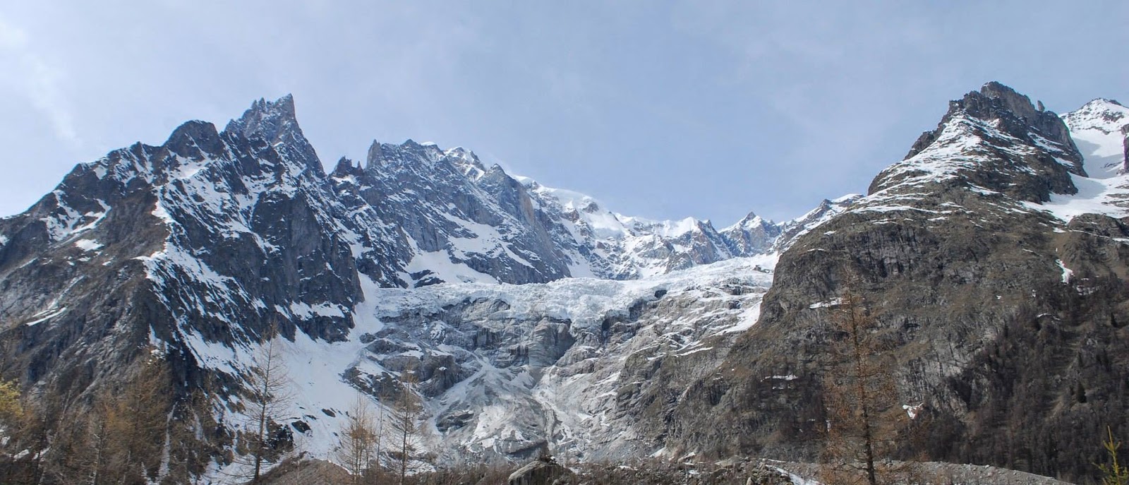
Miage, April 2014

WOW!

Awesome week of fieldwork!  This time last week, I was just approaching the mountains after a dull AutoRoute drive through France for the previous 6 hours, not fully prepared for the wonderful sights of Courmayeur, Val Veny and the Miage Glacier.

The week was a clear contrast between long days of hard work and physical exhaustion (at least on my part) and more chilled days where we recovered our feet from 12hours or more of climbing, walking, standing and ,of course, skiing in rigid plastic boots and organised ourselves for further fieldwork.. all under the comfort of warm spring sunshine.


The first day was occupied with obtaining our rented skis which the gentlemen at the rental shop seemed to have trouble correctly sorting the bindings (I grew to hate the delicate precision of attaching my feet into those bindings!).  Secondly, we had to venture to the storage of more temperature loggers stored at the Fondazione Montanga Sicura above La Palud where our hotel was.  By the time we had lunch at 2pm, we thought we really should do some work... and with temperature loggers programmed by an incredibly slow notebook laptop, we drove ourselves to the Brenva Glacier road and attached our feet to some nice lightweight 600 euro skis.  With skins on our skis and with the snowsled in tow, we hauled the tripods, radiation shields and temperature loggers several kilometres to a suitable site to again test the temeprature readings under snow conditions (more on that next time) before beating the sunset back to the town.

The second day was dominated by a reasonable amount of rain and poor visibility as we had seen on the forecast, and therefore was a day we had set aside for other work and prepping for the rest of the week.  However, what we hadn't fully accounted for was the increased instability of the rock face above the small town of La Palud where we stayed, and the whole place had to be evacuated that morning.  Realising that equipment had to be stored at the Fondazione for summer, it was a slight race against time, in the opposite direction to traffic to store this equipment before the town was blocked to almost all access! It felt a little like a scene from a movie at one stage... Unfortunately, the siren didn't sound as they promised...that would have added to the Hollywood feel.

Wednesday was our first day onto the glacier, although with some effort.  We managed to elect the help of local restaurants and businesses in the valley who operated snowmobiles to transport food and equipment to ski lift areas in the valley en route to the glacier (Val Veny).  Then we collected the equipment from Monday's adventure and pulled the snow sled up some even greater inclines.  Some more locals helped with another old skidoo (snowmobile) which I jumped on eagerly and held onto the snowsled which raced behind us and almost ripped my arm from its socket.  Only until the route became much thinner and steep sided and the skidoo went over with me and the driver on it.  He spoke no English, and I, no Italian beyond the very basics... but we organised ourselves to lift the heavy skidoo, dig it out of the snow and turn it around.  After waiting for the rest of the party, we stashed the sled, took a tripod each and climbed the 200m moraine to get the first real glimpse of the full glacier!  After installing 3 stations on the lower glacier I undertook my first proper downhill skiing session through the forest at the tongue of the glacier... not the easiest experience and after several struggling attempts to mess with my bindings I was tired and ready for a pizza!  We got back to the Brenva road at 9pm, 12 hours after leaving.

The following day was the largest ascent, utilizing the local snowmobiles once more as far as possible, collecting the remaining equipment we stashed the previous day and getting onto the glacier from the far west side of the tongue past the Lac du Combal.  I realised quickly that I was the best at going uphill.... downhill, lets not talk about that so much.  With 3 more stations installed, the ski downglacier commenced.  The parts where I could stop myself were reasonably good fun I must admit, the steeper parts... less fun for me.  I donned my climbing helmet due to the covered debris which i would likely fall onto at some stage in my downhill venture.  But the whole experience was fantastic and great to witness some snow on the glacier before the melt fully encapsulates the surface and the full display of debris becomes apparent.

The final day was an organisation of the notes made, pictures taken and packing and cleaning the van before returning back to the UK + relaxing in the sun with a beer and messing with the time lapse equipment (non of this on the glacier just yet).

I will most definitely share a greater level of detail of the 'science' in a post soon, but for now:

PICTURES!


The massively retreated Brenva Glacier, visibly restricted to a fair sized ice fall, with the debris it initially deposited acting as a nice little obstacle to climb before entering the valley toward the Miage.


Snowsled pulling toward the calibration site on the first day (~4pm).

Calibration test at the bridge just before the small settlement of La Visaille. 


Snowmobile ride back to calibration site 2 days later.


As we stashed the sled (well hidden!).  


Just after the moraine climb on Wednesday, tricky to walk in ski boots, glacier view almost in sight.


The view toward the tongue of the glacier.  Patchy sow and thick debris underneath... interesting skiing.  


More station set up... clearly having fun.  


Next day, western moraine ascent, me up top.  


Toward the upper part of the glacier, heading for highest site we placed until June.  In the distance are the tributaries of the La Tete Caree, Bionassy, Dome and Mont Blanc Glaciers.  


Skiing down glacier :) 


Back to the lower glacier for a data download (we forgot the cable on the previous day), helmet for safety around 'radiation' shields.  


Would like to mention a great thanks to April's wonderful field assistants:

Ingeborg Pay (oh Deer)


Saskia Gindraux

 (Photo not representative of fieldwork Saskia, I just think it's funny :) )


Clare Webster

(At least en route to fieldwork)


And special thanks to:

Dr Philip Deline (Université de Savoie)
and
Dr Ben Brock (Northumbria University)


Wednesday, 2 April 2014

Packing stuff... mostly fun stuff

Only 3 days until an alpine adventure!

Not much left to do, but its been a reasonably busy week gathering all the necessary equipment and gear that I need for next week in Italy.  The main issue being the amount of stuff I'm taking compared to the amount I actually need next week is quite large.  As I will be flying to the field site on successive occasions, I need to take all (or most) of the bulky or heavy items in a lovely two day car journey (incl. stop over and ferry) between Newcastle and Courmayeur on Saturday.

The kit list is made even bigger by the concerns over safety when on the glacier.  Those who remember the crevasse safety course and my beautiful figure 8's from last weeks blog will know that crevassing on part of the glacier is an issue enough to take harnesses and some standard climbing/crevasse rescue gear.  Considering the snow conditions and the current and predicted weather (accessed from the Italian Snow and avalanche forecasts), crevasses on the upper regions of the glacier aren't going to be an issue really, but it's nevertheless better to have the equipment and not need it that vice versa etc etc....

No, the main trouble is the risk of avalanches which is commonplace among skiers and alpine trekkers in such mountainous regions, particularly at this time of year when rising temperatures develop hand in hand with continued solid precipitation (snow).  As a result, the department at Northumbria University has invested in some avalanche safety gear, which typically consists of a transceiver/beacon, the size of a large 90's phone which makes a lot of beeping noises when nearby to someone trapped under avalanche snow,  a trusty extendable prodding stick known better as an avalanche probe and a lightweight pack away snow shovel.. to erm... shovel?
Whilst the risks associated with avalanche dangers are much higher than other glacier related risks for this small trip, all necessary precautions will be taken, summing up the level of risk from forecasts as well as with common sense and observations at the time.  Conditions can change reasonably quickly, which then may boost up the level of danger associated with snow sliding very quickly down a slope!  We all know that weather forecasts aren't 100% accurate... right??  So of course, it makes sense to keep up to date with new forecasts as close to the time as possible when weather predictions are the most accurate, and therefore, the assessment of avalanche risk is as well.

Anyway... back to the original point.... lots of equipment to think about this week.  Though most of it is now in boxes and taped up with labels (such as 'big ass battery' and the like).


It was a fair amount of work to organise all this... so I needed a posing shovel picture.  

Generally, what we have (assuming you can see the numbers) is:


1) The highly untrustworthy 2 metre tripods which I discussed a few weeks back (9 in total in the TomCave)

2) A box full of all safety equipment including crevasse rescue kits, snow anchors, snow avalanche transceivers, shovels and probes as well as spare batteries for all equipment

3) A Kovacs ice drill complete with 6 flights (extensions) and a lovely handle.... fun for all the family

4) A box full of different sized (MET20/MET21) radiation shields to house the temperature sensors

5) All temperature/science equipment for the stations and automatic weather stations (the box underneath has a neat little solar panel to take to Italy (hoping for some sun!)

6) Another new addition to the Northumbria family of toys... A SnowSled expedition Pulka to pull the equipment up to the glacier (I had a quick trial of this one in the office... See below)


7) All the rest of the stuff... GPSs, metal to stabilise tripods, bolts, beer, porn mags, man stuff! (joking about 2 of the previous... let you decide which).  Finally some long white PVC plastic water pipes acquired from B&Q:


I'm not trying to re-route the glacial meltwater to my own little camp (though this a good idea!), but instead using these 2m pipes as ablation stakes to measure and quantify melt of the glacier at the surface compared to what we are predicting to happen.  And that's where the drill comes into it.  

Also like to point people toward a great blog post I was reading last year on Antarctic fieldwork by Bethan Davies (read it here), and all the planning and logistics involved (most certainly more than this instance)... It is a nice summary and some great pictures too... worth a read if you are thinking about any kind of fieldwork loosely similar to this.  

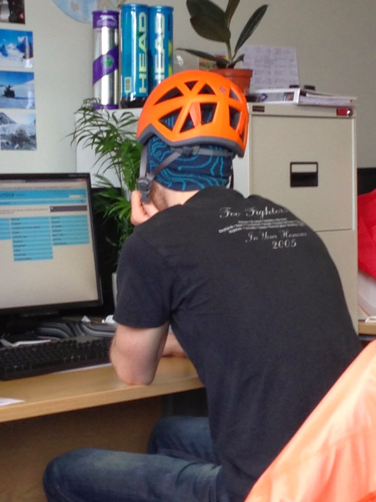
I should most certainly give credit of these shots of me in my day-to-day activities to my friend and colleague Mark Allan, who also challenged me to wear my new climbing helmet all day around the office and the university grounds for the reward of £10!


It was going well, until I realised I wasn't undertaking a full day of work anyway, and the bet was rendered void.

I lasted 90 minutes.

Now... on to fieldwork!

Assuming I'm not left buried under mountains of snow next week, my next blog post will be some nice pretty pictures.

Until then... Arrivederci


Monday, 24 March 2014

Tom Training

What's big, black and sometimes a little scary?

  and it's not this guy..


no...........it's this guy....


And I'm not talking about me with a sunburned face.  But instead about the wide fracture in the glacier ice as a result of various stresses and strains associated with it's flow down-slope.  These crevasses are amazing things to witness and staring down into the abyss is very intriguing, particularly when you can hear the fast flow of englacial/subglacial water channels.  It seems generally important to not fall rapidly to your potential death down one of these things, and its simple enough to follow that advice when you can see them all.  In the above picture on Hellstugubreen in Jotunheimen of southern Norway it seems like these crevasses are reasonably visible... but parts of the ascent up this ice mass involved some probing of snow and some worries when the ice axe disappears from you.  We were pretty lucky in this instance and pretty careful... but the greatest level of preparation can never 100% prevent a fall into an unseen crevasse, and thus its important to understand how to get yourself or another out.  

This week has been all about training for me for the coming fieldwork in less than 2 weeks.  On friday past, the task was just this... to practice crevasse rescue techniques... where else but the Lake District, home of glaciers....  True, the presence of glaciers is particularly absent in England, but the setup of this training was pretty awesome.  

A purpose built barn structure, rather cold (good to simulate conditions in some glacial instances... though not intentional) with bolts, karabiners and ropes here, there and everywhere.  The course was a full day focusing on the techniques of roping up for glacier travel, climbing up a rope yourself using prusik knots and a bit of strength and establishing a system of ropes, slings and pulleys to make lifting someones full weight a lot easier.  Having spent the last few months getting involved with some top rope indoor climbing, roping myself into harnesses was something I felt a bit more confident with... but it's clear to me that i'm someone who takes a while to engrave knots into my mind and make them second nature.  undoing knots is my true weakness! :/


Getting a little too close to another mans special area doing this, but important to be able to take charge and rope in someone else during glacier travel.  Would love to say Mark had no idea in this picture and I had to help him.... truth was my trouble with engraving knots into my brain was taking over when doing it to someone else.  


Oh yeah... log lifting! (simulating a dead weight of an unconscious crevasse victim of course! :P )


The course was fantastic, taught well with a mixture of hands on and some theory and thinking.  To anyone looking to do some training for crevasse rescue or to refresh existing knowledge, I would highly recommend Distant Horizons

Considering the cover of thick snow during the field excursion in April, and the minimal crevassing on the Miage as a whole, the requirement for conducting fieldwork was more to be able to ski...

And I can happily say I'm suitably capable for the shallow incline of the glacier following 6/7 hours of me speeding downhill with a plank on each foot at the indoor snow centre in Castleford (Xscape).  The training, which I was less willing to fork out the money for, seemed even more appealing with the payment coming from a training budget from my external funding source (necessary training... I think so! :) ).  The costly lessons were even more worthwhile considering I was one of two people for a whole day tuition (usually ~10 people) and the other went home after about an hour not feeling well... thus 1 to 1 lessons from someone who had been an instructor in Courmayeur and was familiar with the Miage Glacier.... success! 

Unfortunately I don't have a picture of me skiing like a pro... but just use your imagination.... I only fell over a few times, and only when getting into the spirit of parallel turns on the steeper upper parts of the slope.  Generally happy considering there may be some spare time in April for some recreational skiing... but that is to be determined...  

...you can call me Tomski

Sunday, 16 March 2014

The science of bad glacial tripods

The weeks are flying by! ...and among other work this last week, I have been thrown back to a task which I feel reasonably inadequate at performing... that would be metal work.  The last time I was in a workshop, clutching some small metal trinket, I was about 12 years old and in year 8 at school.  I was generally useless and D+T/metalwork/woodwork and the idea of going back to that worried me somewhat.  Flopping anxiously into a workshop of the university with departmental safety boots a size too big, not entirely sure which saw would best fit my needs.  Considering the type of mans man who tends to operate in such an environment (which I guess I'm not), I felt a little useless not knowing the name of all the tools and the best technique for using them....

However, I was saved from this by the fact that I simply had to cut some metal plates in half and was able to use a guillotine to do it in seconds.  The fact that the workshop tech squeezed my bicep afterward just reinforced my discomfort with such encounters..

The point of the whole ordeal is an attempt at stabilizing the tripods I need to hold my temperature loggers in the air, as the ones the department have would likely fall over after someone sneezes on them.  The 13 kilo steel tripods seem to have some stability on a flat surface to which it can bolted to- however, given the uneven nature of a glacier (before you pile as much as a metre or two of avalanche debris on top), it becomes a bit more tricky.

The obvious answer seems to drill the whole thing into the ice and save the hassle.  However, the idea here is to capture the temperature of the air near the surface but at a height that is the intermediate between the 'free air' and the air within the glacier boundary (see awesome drawing).  This Screen height is typically measured at 2 metres above the surface.  Because the surface of ice (assuming it is bare) cannot exceed melting point (0 degrees C ), it affects the air at the near surface that is warmer during the summer melting season.  As a result, this colder surface acts to 'dampen' the temperature changes close to the surface, which does not accurately reflect what is really changing in the air.  Therefore, looking back at our tripod: drilling it in to the ice, it will rarely remain at a constant height above the surface when the ice melts and when snow disappears.


That leaves us with option of a free-standing tripod... which sucks considering the success rate of the same tripods on a previous field season at this glacier.  Furthermore, as the surface experiences a non-uniform movement/melt, tying the tripods to something, could also act to tip it.  Annoying :/ .

As a result, I have had to make my way to a B&Q (which has proved rather challenging to get to larger stores without a car in Newcastle) in order to throw myself into more situations where I feel completely unsure of what I'm doing.  NOTE:  Informing a staff member of what you plan to do does need lead to any progress on finding something suitable when it comes to temperature tripods and glaciers.  Hopefully stabilizing the tripods with half metre strips of metal on its feet proves to be successful, but we shall see between April and June.  I'm half expecting to be rather annoyed come June when I visit the glacier to see my tripods sunbathing on the glacier surface.  An example of the type of metal strip I'm referring to can be vaguely seen in the picture below where all the tripods from the indoor calibration tests were bunched together (slacking with my photos):


But all in all.... the setup of these tripods is very simple.  The loggers can be operated by a monkey (coincidence!), the radiation shields work well the protect the thermistor probes from direct radiation to give an actual indication of air temperature (see the test below), and the stuff is mainly held together with copious amounts of sturdy tape and cable ties at the 2 metre screen height.


 One of the Tinytag loggers (TT3) was tested in the outdoors with one probe housed comfortably in a radiation shield to protect from direct heating, while the other had to bake in the clear skies that we saw during the midweek.  The upper graph shows the temperatures we are referring to until the irregularities at around 10pm on the 13th where it was brought in from the garden.  The clear skies and south facing aspect of this garden mean that conditions were ideal to test the importance of the radiation shields.  As can be seen from the bottom graph, the differences were high during the peak midday hours, showing differences in excess of 4 degrees C at times.  Considering the accuracy of these loggers in stable indoor conditions last week, the differences are significant and would severely hamper any accurate understanding of temperature differences.  Lucky we have all the radiation shields we need :) .

Therefore, I'm not too worried about the accuracy of the data at this point, more the fact if it stays in the place I want it to!


Sunday, 9 March 2014

Winter? what is that? (says the Englishman)

I'm sure we have all sat in a room at some point and tried to guess what the temperature is ... and usually a guess that's roughly within 20°C plus or minus.  Maybe it was back at school when the heating had broken and below a certain temperature, class had to be cancelled (I was this fortunate only once!).  Or maybe, you are like this guy with his funky headwear, trying to figure out how many layers you need.  

Either way, I realised I don't have too much difficulty in working out the temperature... mainly because I'm surrounded by 10 different sensors that are capable of recording data every second on air temperature and relative humidity of my little secluded hideaway.  I don't want make it sound like the Bat-Cave or anything.... but its the TomCave! (trademark).  


...ok, so it's the old boiler house at the University which has more dust than equipment... but either way its my little hideaway spot.  

Basically, in preparation for some fieldwork in the Alps next month, I need to test all of my temperature sensors and the logging systems before installing them on the glacier.  In order to accurately understand the temperature differences across a glacier when it begins to melt, I have to make sure all the sensors are reading approximately the same temperature under a (more) controlled environment.  Thus, the TomCave acts as a nice spot, sheltered from the effects of wind, but with a nice window to allow the sensors to record a daily cycle of temperature under impact of the sun (and how they all respond to this change).  

What we get is this:


The graph here shows the typical cycle of air temperature with peaks between midday and around 3-4pm as would be expected.  Interestingly during the 6th March (the fourth 'peak') the difference between the high daytime value and the night time low is very little.  This would suggest a cloudy, overcast day which persisted during the night, trapping the outgoing heat from the earths surface.  But the crazy thing to notice, is the dates and the associated temperatures... I think we should have all noticed (in the UK and over parts of Euro-Scandinavia) what a crazily mild winter we have had, with warm-ish temperatures and endless rain.  Highs of 15.5°C at the end of this graph support this early onset of spring (if winter ever came at all) assuming we ignore the start of this graph where I held my hand on the sensor just to.... test science and such (hence the 21.5°C maximum at the start).  
Fellow people from Minnesota and parts of the US that I know would argue very differently the case of the disappearing winter.  As this guy and his crazy dress sense indicates, the presence of the Polar Vortex over the US and Canada this winter has given them something to grumble about, perhaps even deny climate change on the grounds that its gone a bit colder this year.  

A brief BBC News overview in case you have been living in a hole, or perhaps you got frozen solid at the beginning of it, and having recently thawed, you are wondering what the hell happened. http://www.bbc.co.uk/news/world-us-canada-25831549  .  

Either way, considering the maximum temperature between 1981-2010 at Tynemouth is recorded as 9°C, the presence of 15.5 at the beginning of the month seems pretty significant. (Historical data source: MetOffice: http://www.metoffice.gov.uk/public/weather/climate/newcastle-upon-tyne-newcastle-upon-tyne#?tab=climateTables).  

Personally, I'm waiting for a small, cold snap of winter weather before spring becomes fully incorporated into the mood and dress sense of Newcastle's population (excluding the night time experience :S ).  


I digress!.... Looking back the same graph but more zoomed in:


The air temperature during the day of March 5th (middle peak on first graph) measured at 10 minute intervals is expressed by the main black and blue lines, with the boxes showing the maximum and minimum values recorded within those 10 minute intervals.  The lines show some very minor variations between two sensors which are under near-identical conditions.  However these differences are less than one tenth of a degree, which is a reasonable similarity of measure considering the manufacturer indicates an accuracy within a twentieth of a degree (0.2) of these sensors.  

This will need to be tested under alternate conditions before being installed on the glacier in April when all the temperature loggers are in the same place (half currently being in Italy already).  But that is a job for the near future.  

I will be very interested to see the range of temperatures found during this field season in comparison with the general findings of previous studies, if this (European) winter is anything to go by.  However the differences between the air temperature measured in the TomCave and those measured above a glacier surface are something to consider... more on that next week.  

:)


Sunday, 2 March 2014

I think I've been approved... let's do some science

What has 14 points and gives me a stupid grin?...... and its not a football team (especially as that would currently be a conference team like Hyde or similar, and that is nothing to grin about)..

The answer:


A sweet pair of new crampons for fieldwork/ playing around on ice... YEY!

Granted at this stage, they aren't 100% required, considering April fieldwork involves a lot of snow and use of skis/snowshoes... and in summer, there is mostly debris on the lower glacier area..  However, upper areas of the glacier are reasonably crevassed/I have some ambitious aims for where to put my temperature tripods/I'm looking for some recreational ascents around Mt Blanc.

Either way... I feel even more psyched for fieldwork which begins in a month.  Which brings me back to my point for this weeks blog.. project approval.  Last week, I presented a 10 minute overview to my project background and my aims for the 3 years I am studying at Northumbria and attempted to answer some questions from a small panel of staff at the University...

   ... A question about how to prevent my equipment from being stolen, I couldn't really answer to be honest...

... But either way things went alright, and while I have not had any formal confirmation, I think I'm ok to carry on with my research and all it's serious ethical implications!

Last time I was talking about some potential places where I could place my temperature sensors to capture the typical variability across the Miage Glacier in Italy.  Some places I have concluded to be ridiculously hard/impossible to reach and therefore unfeasible without having a jetpack (should see if I could get this funded somehow).  But other areas have been generally agreed upon and now I have to think about logistics with regards to getting the equipment up the glacier on a sled and where to set up the initial five stations (the rest will be established in summer when we have lots of 'willing' undergraduate students to help carry things).

One idea is the effect slope angles on temperature across a glacier.  Previous studies have highlighted that temperature can be predicted by a simple thermodynamic model, whereby temperature is controlled by the movement of energy between the surface and the air (sensible heat flux) and the adiabatic heating of the air as it descends.  A study by Ulrich Strasser and company (1) found that temperature differences were much greater when temperature was measured at the base of steeper slopes of the Haut Glacier d'Arolla in Switzerland.  A nice picture of this glacier in the snow... just 'cos I have one :)


So to test the consistency of this idea, I am planning to set up two temperature tripods a the base of two tributaries of the Miage Glacier at similar elevations, one which will be at the foot of a steeper slope/ice fall and one at a more gentle incline from the main body of the debris section.  By understanding these differences, we can gain knowledge on the relative impact of these factors.


Using an even more detailed DEM derived from LiDAR survey over the main body of the glacier, we can see the presence of much steeper terrain to test this idea.  The two most central red dots are the likely placements for this test.  The new slope angles shown in the above image (reds indicating steeper slope angles) are derived from this LiDAR data which has a spatial resolution of 2 metres (meaning that each pixel of the image corresponds to 2 m in reality).  This is an improvement from the resampled 10 m resolution that can still be seen to the left of this image.  However using this high level of detail in distributed melt modelling would require a lot of processing power which is likely to be unrealistic and unnecessary for my work.

Next job: test and calibrate the temperature sensors and get the tripods in good working order... accurate results are needed!


(1) Strasser, U., Corripio, J. G., Pellicciotti, F., Burlando, P., Brock, B. W., & Funk, M. (2004). Spatial and temporal variability of meteorological variables at Haut Glacier d’Arolla (Switzerland) during the ablation season 2001: Measurements and simulations. Journal of Geophysical Research, 109, D03103. doi:10.1029/2003JD003973